
Contrary to one of the better geographical illusions, we realised that we were no further north at the end of the trip than at the start - it did, however, feel as though we were in a different country!
Wellington is a pleasant enough city, with a setting nestled around a natural harbour with hills in the background. As the capital city, there is also plenty going on and it is viewed as the cultural centre of the country - indeed it is given the tongue in cheek name of 'Wellywood' by some, after the small film industry based here.
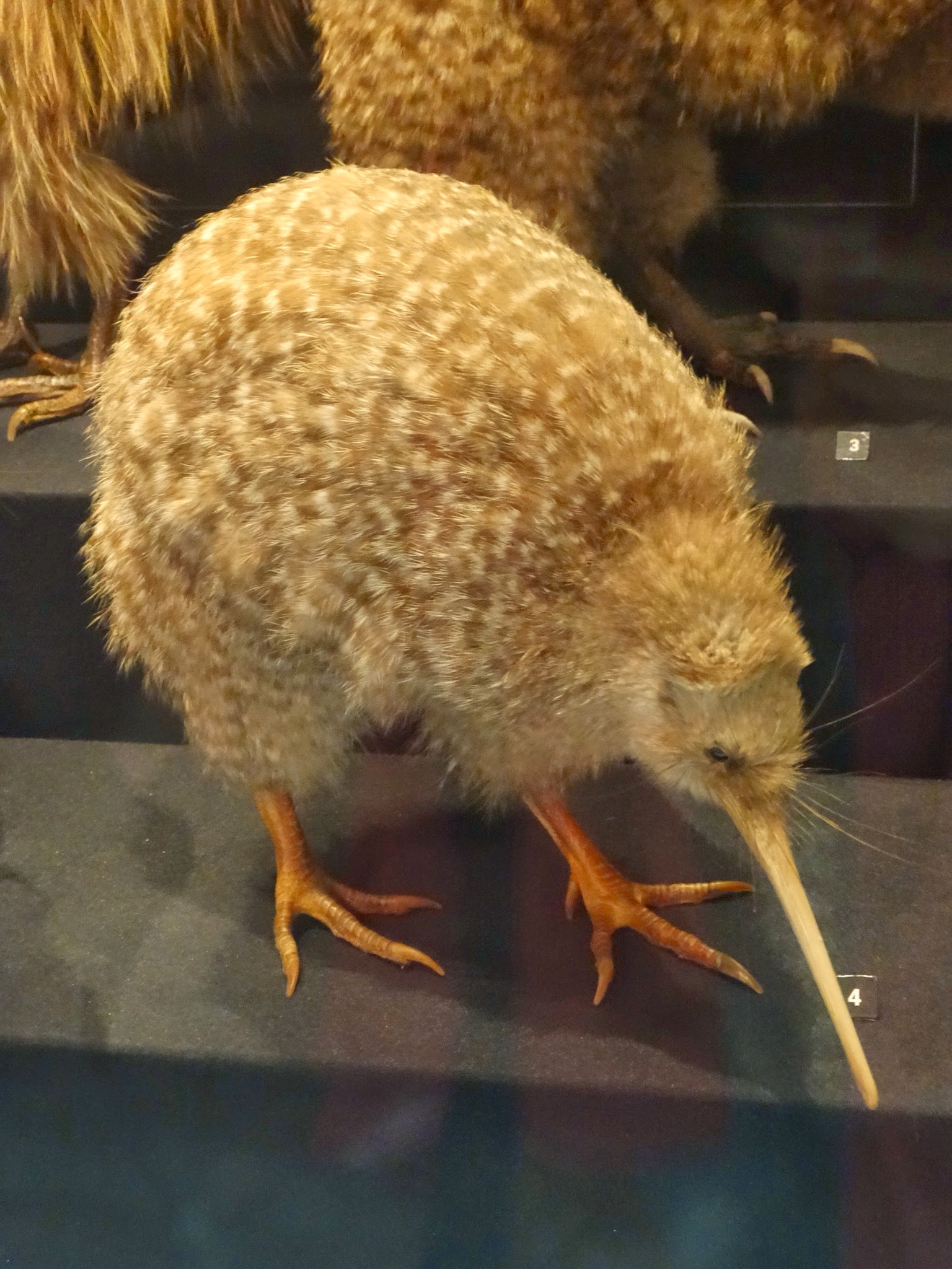
We had just one full day to spend here and headed first off to the renowned Te Papa Tongarewa Museum - Maori for 'treasure box'. There were some interesting exhibits on the tectonics of New Zealand, including a mock earthquake: we entered a small traditional house that rocked and shook as we closed the door. Suffice to say, that if one were worried about earthquakes, this would probably be the very last place on earth that one would choose to live!
Also of great interest, was the sections on Maori culture and history. We had seen very little Maori influence on the South Island, though here, it was much more in evidence the further north we went. It seems that, as in India, the British got good at the art of 'divide and rule', with a sprinkling of duplicity thrown in for good measure. The Maoris had a strong military tradition and were fierce warriors. If they hadn't been distracted by fighting amongst themselves, they would probably have been a match for the British. A particularly good example of this, was a long running feud between the Te Arawa and Waikato tribes. In the 1860s the Te Arawa tribe colluded with the British government, sensing a chance to finally defeat the Waikata (who had invaded their lands in the 1820s). The Te Arawa won, but the real victors were the British!
Also housed at the museum were original copies of the Treaty of Waitangi, signed on 6th February 1840 (and celebrated as the birthday of modern New Zealand). I say 'copies', because there were 2 quite different versions - one in English, one in Maori. The Maori version skirted around thorny subjects such as the 'sovereignty' of the British crown, never explicitly stating that Maori Chiefs were subject to British authority (a concept that didn't exist in the Maori vocabulary). This duplicity, allowed the British to cement their control over New Zealand and as this was strengthened, the Treaty was regularly breached when it suited, to take control of valuable land.

Outside of the Museum, we found that the Wellington Festival was just kicking off, with a month of theatre and music all around the city. We were lucky to get some tickets to a premiere of a new play, 'The Diary of Charlotte Bronte'. It felt slightly strange being on the other side of the world, watching a play about one of the Bronte sisters and, not long before leaving the UK, we had visited the Bronte family home on the Yorkshire Moors with my aunt and uncle. The play, done in monologue form, was a triumph - wonderfully acted and scripted and we were both entranced by it.
It was the weekend in Wellington and, particularly on Saturday night, the bars and clubs were pretty lively. At around 4 am on Sunday morning, we were woken by the sound of a mass brawl on the street outside our hotel. We peeked out from behind the curtains of our 4th floor room to see one guy lying semi-conscious on the ground and the place was soon swarming with police and paramedics. This felt just like an English town centre on a Saturday night!
Heading on from Wellington, we were back on a bus, for the 6 hour drive up to Lake Taupo, which we used as our base for 3 days. The bus took us initially through gentle, green farming pasture (going close past the area where, in 1989, my friend Darran and I worked on a sheep farm for a couple of weeks), before the land became steadily more volcanic, with craters jutting menacingly out of stark grey-green lava fields. It didn't take much imagination to picture these fields glowing red with burning magma.


A volcanic cone near Taupo
Lake Taupo itself was formed 26,500 years ago, by one of the greatest volcanic eruptions ever recorded - it spewed out nearly 100 times more volcanic debris than the famous Krakatoa eruption. The resultant caldera is now NZ's largest lake at 606 square kilometres and feeds its longest river, the Waikato. The weather was warm and calm whilst we were here and on such a day it was hard to accept the violent conception of this serenely beautiful lake.After the excitement of Wellington, we stayed in a quiet backpackers lodge. Although these places make us feel very old, this one had a great verandah and we were able to eat our evening meal with a glass of wine, with views of the sun setting over the lake.


Back on the road, we continued northwards to Rotorua. Interestingly, as we headed north, the place names changed from English (Christchurch, Queenstown, Wellington) to Maori (Rotorua, Turangi, Whangarei). On the edge of Rotorua, we visited a Maori village that had taken their place naming to an extreme: welcome, we were told, to Tewhakarewarewatangaoteopetauawahiao - or Whaka for short. We felt suddenly sorry for the Welsh: we already knew that they were outdone by Kiwis for their rugby prowess and their love of sheep, now we found that their place names, by comparison, are short and pronounceable!
More seriously, though, 'Whaka' was an interesting place to visit. It was a traditional Maori village, built upon an area of sulphurous steam pools and silica terraces. Here geysers spurted steaming water metres into the air, boiling water bubbled to the surface and gloopy mud spluttered like porridge on a hob. The villagers did, indee, use the waters to bathe and to prepare their food. We watched a women lower corn-on-the-cob in a muslin bag and in seconds it was ready to eat. The downside to all of this was the acrid, eggy stench, which made our eyes water and heads spin.
We took a local bus to and from the centre of Rotorua and we were struck by the fact that suddenly we were the only non-Maori people on board. Around one third of the North Islands population is Maori but it seems that they tend to be focused in 'indigenous' communities, which are generally much less affluent than the predominantly white areas. It was an interesting comparison with the situation in Australia. Our initial view, was that with a much larger population Maoris are less marginalised than their Australian Aboriginal counterparts, albeit with some significant social and economic depravation issues.


Heading on from Taupo and Rotorua, we took a long bus ride up to Auckland, where we picked up a hire car from the airport. Relying on buses can be restrictive and we found a good deal on a car for 4 days. This allowed us to do a great tour of the 'Northlands', heading up the east coast almost to the far extremity of the island and then back down the west coast. It might not look like it from the first glance at a map, but the North Island stretches for a further 250+ miles north of Auckland.
Whilst nothing was going to match the drama of the South Island, the scenery in this far extremity of the North Island has a beauty all of its own. Particularly striking was the east coast, where the scenery got better and better and steadily more tropical, as we headed north.
Once the suburbs of Auckland ran out, the road ran through forest and then followed the coast along cliff-tops where we looked down on bright blue seas and long curving tracts of deserted white sandy beaches. The highlight was meant to be the Bay of Islands, where Aucklanders come for the beaches and sailing trips out to a multitude of islands that liberally dot the coast. It was indeed beautiful, but for us it was trumped by the more rugged landscapes further north. We found ourselves driving for miles on narrow dirt track roads lined with thick, pristine native forest; occasionally reaching vista spots where we could see for miles without any evidence of human habitation.


 O
O


At the end of the road on the east coast, we had one of our nicest overnight stops, at a farm stay. The farm was run by a kiwi woman and her Italian husband. It had been in her family since the late 19th century and she was continuing to run it, and the accommodation, with incredible energy. On arriving we were told to follow her as she wheel span off the road and into the hills for a couple of minutes, eventually reaching the original 19th century farm-house. This charming, wooden clapboard house (with surrounding verandah, ornate carved gables and views over rolling hills) turned out to be solely ours for the night and we had the choice of any of the 5 bedrooms and full use of the house with its original wood burning stove and wooden furniture. First though we had to help our host to recover her prize pure-bred ram which had darted through the gate as we drove up to the house!
The west coast was the opposite of the east coast: at the northern end, it was bleak and uninspiring only getting more interesting as we got closer to Auckland. Part way south, the road ran out at the mouth of the Hokianga river and we had an entertaining interlude crossing on a small old ferry that chugged back and forth across the estuary, taking up to 20 cars a time.

Further down the coast, we skirted inland and through a national park aimed at protecting some of the last of the ancient kauri trees that used to cover much of the northern part of the North Island. These majestic trees took a thousand years to grow to their full might, but just a few human generations to almost wipe them out! We took a few minutes to sit in front of the largest remaining tree and felt dwarves and suitably humbled.

On our final full day in New Zealand, we completed the last stretch of the north-west coast back to Auckland. On the way were the most dramatic parts of the west coast at Karikari, Bethells and Muriwai beaches. Each of them was reached from high above on roads that descended steeply, switchbacking down the forested hillside. They are each famous locally for their black volcanic sand, set against the back-drop of the precipitous cliff tops and the surf that pounds in, making them perilous for swimming, but setting the gold standard for surfing in NZ.
Muriwai beach is also famous for its thriving gannet colony and we were able to walk along the cliff top and view them from above, as they packed themselves densely onto a great slab of rock. Our final stop of the tour was Karikari, a wild, wind-swept expanse of black sand fringed by thick forest, that was used as the film set for The Piano - a wonderfully atmospheric film, for anyone who hasn't seen it.


So, our time in New Zealand was over and we were heading back to Australia. We devoted a month to our trip, but could easily have doubled that; at times we probably over did it, in our attempt to see as much as we could. We also feel that we didn't have as much interaction with the locals as we would have liked, so focused were we on taking in the natural wonders it has to offer. Nevertheless, on the whole it was probably the most peaceful and enjoyable leg of our journey so far.
On the 3rd March we flew back to Sydney, with a strong feeling that we were now starting our move homewards. In the next post, we will tell you about our return to Sydney and onwards from there.
No comments:
Post a Comment